From the entrance at the end of Strang Boulevard, the Strang Trail (white) enters the woods on a wide trail. Turn right onto a narrow path and, at 0.1 mile, go straight onto the Hunter Brook Trail (red) to cross a small bridge. The trail begins a long descent towards Hunter Brook. At 0.5 mile, it turns left onto a woods road, crosses Hunter Brook on a large stone bridge, and heads uphill to...
Hike Description:
From the entrance at the end of Strang Boulevard, the Strang Trail (white) enters the woods on a wide trail. Turn right onto a narrow path and, at 0.1 mile, go straight onto the Hunter Brook Trail (red) to cross a small bridge. The trail begins a long descent towards Hunter Brook. At 0.5 mile, it turns left onto a woods road, crosses Hunter Brook on a large stone bridge, and heads uphill to end at the Strang Trail (white). Turn left to go slightly downhill and cross a wooden bridge. The Strang Trail heads uphill and when it reaches the Legacy Trail (green) at 0.7 mile, turn right. Continuing uphill, the Legacy Trail goes below the fencing of the large athletic field, crosses a gas line at 1.0 mile, and reenters the woods. When you reach the Taconic Bridge Trail (pink), turn right to go to the Parkway Trail (blue). Follow the Parkway Trail as it makes sweeping turn down the hill through open woods.
At 1.4 miles, the Parkway Trail crosses the Taconic Bridge Trail which goes over the Taconic State Parkway. Make a sharp left on the narrow path avoiding the gravel road. When you reach the gas line, cross it and reenter the woods on a wide woods road. At the junction with the Woodlands Trail (yellow) at 1.6 miles, turn right to stay on the Parkway Trail and head downhill. The trail parallels the parkway and, at 1.8 miles turns to parallel Hunter Brook, sometimes closer than others. It crosses feeder streams on small bridges and ends at the co-aligned Strang and Woodlands trails. Turn right at 2.1 miles to cross a bridge over Hunter Brook and on the other side of the bridge turn right again to stay on the Woodlands Trail (yellow). For a slightly shorter hike, at the end of the bridge turn left on the Strang Trail to reach parking at 2.3 miles. You will parallel Hunter Brook for a second time and, at 2.3 miles, turn left to leave it. After heading steeply uphill, the Woodlands Trail reaches the top of the rise at 2.6 and then ends at the Strang Trail. Turn right to return to parking.
Publication: Submitted by Walt Daniels on 12/01/2020 updated/verified on 12/01/2020

The hike goes around the perimeter of the park using all or parts of all but one trail. It frequently is along Hunter Brook.
41.303319, -73.819683
Westchester Co., NY
3 mi
1.3 hrs

Web Map: Woodlands Legacy Field
Buy Book: Walkable Westchester
Avenza App Map: Woodlands Legacy Field Park
Hike Checklist:
Whether you are going for a day hike or backpacking overnight, it is good practice to carry what we call The Hiking Essentials. These essentials will help you enjoy your outing more and will provide basic safety gear if needed. There may also be more essentials, depending on the season and your needs.
The Essentials
Hiking Shoes or Boots
Water - Two quarts per person is recommended in every season. Keep in mind that fluid loss is heightened in winter as well as summer. Don't put yourself in the position of having to end your hike early because you have run out of water.
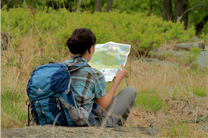
Map - Know where you are and where you are going. Many of our hiking areas feature interconnecting network of trails. Use a waterproof/tear-resistant Tyvek Trail Conference map if available or enclose your map in a Ziplock plastic bag. If you have a mobile device, download Avenza’s free PDF Maps app and grab some GPS-enhanced Trail Conference maps (a backup Tyvek or paper version of the map is good to have just in case your batteries die or you don't have service). Check out some map-reading basics here.
Food - Snacks/lunch will keep you going as you burn energy walking or climbing. Nuts, seeds, and chocolate are favorites on the trail.
Sunscreen and insect repellent
Rain Gear and Extra Clothing - Rain happens. So does cold. Be prepared for changing weather. Avoid cotton--it traps water against your skin and is slow to dry. If you are wearing wet cotton and must return to your starting point, you risk getting chills that may lead to a dangerous hypothermia. Choose synthetic shirts, sweaters and/or vests and dress in layers for easy on and off.
Compass - A simple compass is all you need to orient you and your map to magnetic north.
Light - A flashlight or small, lightweight headlamp will be welcome gear if you find yourself still on the trail when darkness falls. Check the batteries before you start out and have extras in your pack.
First Aid Kit - Keep it simple, compact, and weatherproof. Know how to use the basic components.
Firestarter and Matches - In an emergency, you may need to keep yourself or someone else warm until help arrives. A firestarter (this could be as simple as leftover birthday candles that are kept inside a waterproof container) and matches (again, make sure to keep them in a waterproof container) could save a life.
Knife or Multi-tool - You may need to cut a piece of moleskin to put over a blister, repair a piece of broken equipment, or solve some other unexpected problem.
Emergency Numbers - Know the emergency numbers for the area you're going to and realize that in many locations--especially mountainous ones, your phone will not get reception.
Common Sense - Pay attention to your environment, your energy, and the condition of your companions. Has the weather turned rainy? Is daylight fading? Did you drink all your water? Did your companion fail to bring rain gear? Are you getting tired? Keep in mind that until you turn around you are (typically) only half-way to completing your hike--you must still get back to where you started from! (Exceptions are loop hikes.)
Check the weather forecast before you head out. Know the rules and regulations of the area.
The Leave No Trace Seven Principles
Plan Ahead and Prepare
- Know the regulations and special concerns for the area you'll visit.
- Prepare for extreme weather, hazards, and emergencies.
- Schedule your trip to avoid times of high use.
- Visit in small groups when possible. Consider splitting larger groups into smaller groups.
- Repackage food to minimize waste.
- Use a map and compass to eliminate the use of marking paint, rock cairns or flagging.
Travel and Camp on Durable Surfaces
- Durable surfaces include established trails and campsites, rock, gravel, dry grasses or snow.
- Protect riparian areas by camping at least 200 feet from lakes and streams.
- Good campsites are found, not made. Altering a site is not necessary.
- In popular areas:
- Concentrate use on existing trails and campsites.
- Walk single file in the middle of the trail, even when wet or muddy.
- Keep campsites small. Focus activity in areas where vegetation is absent.
- In pristine areas:
- Disperse use to prevent the creation of campsites and trails.
- Avoid places where impacts are just beginning.
- Pack it in, pack it out. Inspect your campsite and rest areas for trash or spilled foods. Pack out all trash, leftover food and litter.
- Deposit solid human waste in catholes dug 6 to 8 inches deep, at least 200 feet from water, camp and trails. Cover and disguise the cathole when finished.
- Pack out toilet paper and hygiene products.
- To wash yourself or your dishes, carry water 200 feet away from streams or lakes and use small amounts of biodegradable soap. Scatter strained dishwater.
- Preserve the past: examine, but do not touch cultural or historic structures and artifacts.
- Leave rocks, plants and other natural objects as you find them.
- Avoid introducing or transporting non-native species.
- Do not build structures, furniture, or dig trenches.
- Campfires can cause lasting impacts to the backcountry. Use a lightweight stove for cooking and enjoy a candle lantern for light.
- Where fires are permitted, use established fire rings, fire pans, or mound fires.
- Keep fires small. Only use sticks from the ground that can be broken by hand.
- Burn all wood and coals to ash, put out campfires completely, then scatter cool ashes.
- Observe wildlife from a distance. Do not follow or approach them.
- Never feed animals. Feeding wildlife damages their health, alters natural behaviors, and exposes them to predators and other dangers.
- Protect wildlife and your food by storing rations and trash securely.
- Control pets at all times, or leave them at home.
- Avoid wildlife during sensitive times: mating, nesting, raising young, or winter.
Be Considerate of Other Visitors
- Respect other visitors and protect the quality of their experience.
- Be courteous. Yield to other users on the trail.
- Step to the downhill side of the trail when encountering pack stock.
- Take breaks and camp away from trails and other visitors.
- Let nature's sounds prevail. Avoid loud voices and noises.
The Trail Conference is a 2015 Leave No Trace partner.
(c) Leave No Trace Center for Outdoor Ethics: www.LNT.org.
Directions to Trailhead :
From Taconic State Parkway, take the Route 202 Exit 13 and turn east. At the traffic light at Strang Boulevard, turn left to go by Mercy College. It is 0.7 mile to the dead end where parking is limited as to not inconvenience residents. [41.303319 -73.819683]
TRAIN TRANSPORT :
Not availableBUS TRANSPORT :
Beeline Bus #15 stops on Route 202 opposite Strang Boulevard. It is a 0.7 mile road walk to the entrance at the end of the road.
Share Your Experience
SUPPORT
 Support the trails with a donation!
Trail Conference volunteers maintain trails in this hike.
Trip Reports
rate experience
No reviews for this hike, click above rate experience link to review this hike
Log in or register to post comments